
Storm brings wind and some rain
This item is available in full to subscribers.
To continue reading, you will need to either log in to your subscriber account, or purchase a new subscription.
If you are a current print subscriber, you can set up a free website account and connect your subscription to it by clicking here.
If you are a digital subscriber with an active, online-only subscription then you already have an account here. Just reset your password if you've not yet logged in to your account on this new site.
Otherwise, click here to view your options for subscribing.
Please log in to continue |
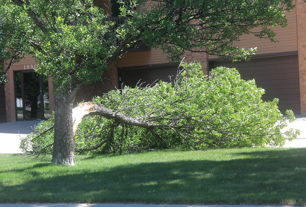
HURON – Tornado sirens were activated early Tuesday evening when strong thunderstorms moved through Beadle County, but the damage appears to have been caused by high, straight-line winds.
National Weather Service meteorologist Phillip Schumacher in Sioux Falls said most of the reports they received from the Huron area came between 6:15 p.m. and 6:30 p.m.
“You had multiple storms moving across that area in that time period,” he said.
The series of storms moved from the southwest to the northeast, generally following the same path, he said. It’s why there was a period of very strong winds, a short, calm period and then a second blast of strong winds.
Wind gusts of 58 mph were recorded at the Huron Regional Airport.
Branches were twisted off trees in Huron, but the strong winds that hit the Cavour area damaged outbuildings, power lines and trees, Schumacher said.
Radar indicated that the strongest and potentially most damaging cells skirted along the eastern edge of Huron as they approached Cavour.
Schumacher said the storm weakened as it neared Highway 81, with winds clocked at 40 to 50 mph in the Salem and Madison areas, but then reloaded to reach 65 to 70 mph wind gusts near I-29 and then into northwest Iowa and southwest Minnesota.
He said one-inch hail was reported southwest of Sioux Falls.
The rain total at the Huron airport was 79/100ths.


